
Đerdap National Park
Golo Brdo to Mali Štrbac, Đerdap
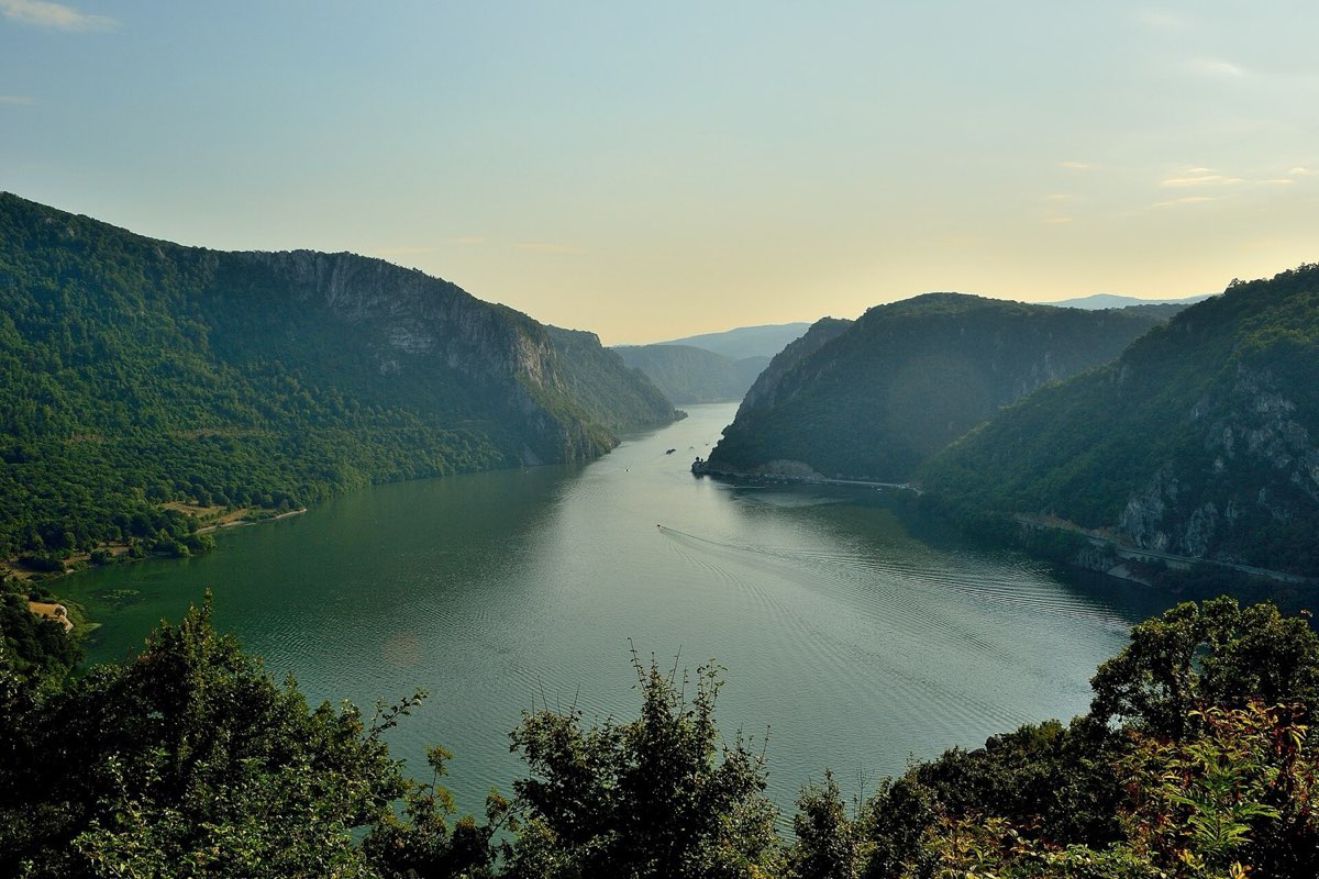
The classic view over the Iron Gates, from a marked national park trail above the Danube.
Quick answer
A 7.1 km marked climb through the forest of Đerdap National Park, from the Danube road at Golo Brdo (254 m) to the Mali Štrbac viewpoint (626 m). Allow about two and a half hours up. Return the same way or go on to the Ploče viewpoints.
Route map
The map loads from OpenTopoMap, which receives your IP address. Nothing loads until you click.
Download GPXWorks with most hiking apps and GPS watches.
Elevation
Quick facts
- Type
- One way
- Start
- Golo Brdo, on state road 35 (254 m)
- Highest point
- 626 m
- Grade from
- Đerdap National Park
- Water
- Not mentioned by the park; carry all you need
- Waymarks
- Marked national park trail
- Best season
- April to October
- Walked by our team
- Not yet. This guide uses published route data
- Data checked
- 1 Nov 2026, online
The route
- Leave the Đerdap road (state road 35) at Golo Brdo.
- Climb along the ridge through the forest. The park gives an average slope of 20%.
- Finish at the Mali Štrbac viewpoint, looking over the gorge to the Romanian bank of the Danube.
Getting to the start
Golo Brdo is on the road along the Danube, between Golubac and Donji Milanovac. You need a car or a pre-arranged transfer. See also our Đerdap National Park guide.
Before you go
- From the viewpoint you can continue to Ploče (about 355 m) for three more viewpoints, then descend by forest path to the road.
- If you leave the trail at Ploče, plan how you will get back to your car.
- The park page mentions no water or facilities on the trail.
Read our mountain safety basics too. For any emergency in Serbia, call 112.
Where to stay
Donji Milanovac is the closest town, with hotels on the river.
See hotelsFrequently asked questions
How long is the return trip?
About 14 km if you come back the same way. Allow four to five hours.
Is Mali Štrbac in Serbia or Romania?
It is in Serbia, in Đerdap National Park. Romania is the far bank of the Danube.
Sources
- Đerdap National Park: Mali Štrbac
- Route line: © OpenStreetMap contributors (ODbL)
- Elevation chart: NASA SRTM data, via OpenTopoData
Checked 1 Nov 2026. Trails, marks and access change, and you walk at your own risk. Confirm conditions locally before you set out.
More hikes in Serbia
All hikes → Moderate
 Demanding
 Easy


