
Tara National Park
Mitrovac to Banjska Stena, Tara
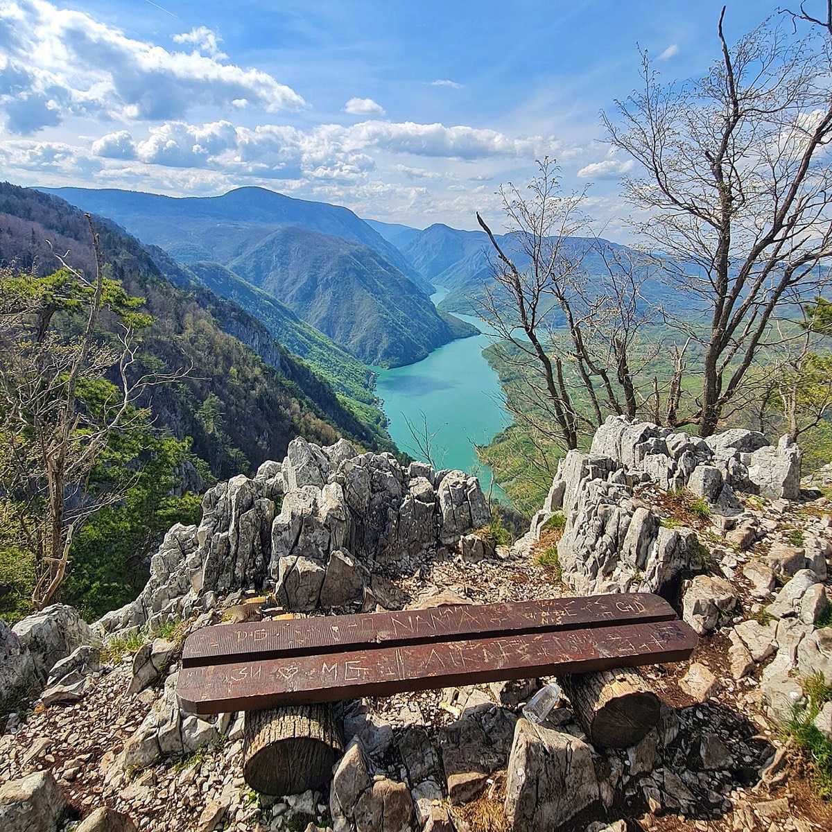
An almost flat forest walk to the most famous viewpoint on Tara, high above the Drina.
Quick answer
Six kilometres of easy forest walking from Mitrovac to Banjska stena (1,065 m), with the Drina far below. Allow about 1 hour 45 minutes each way. A marked alternative returns by a different path, so you do not have to walk the same way back.
Route map
The map loads from OpenTopoMap, which receives your IP address. Nothing loads until you click.
Download GPXWorks with most hiking apps and GPS watches.
Elevation
Quick facts
- Type
- One way
- Start
- Mitrovac, Tara (1,070 m)
- Highest point
- about 1,124 m
- Grade from
- Tara Hiking Club, 1 out of 10
- Water
- 1 drinking water source on the route
- Waymarks
- Marked as route 09, described as excellently marked
- Best season
- May to October; snow in winter
- Walked by our team
- Not yet. This guide uses published route data
- Data checked
- 1 Nov 2026, online
The route
- Leave Mitrovac on route 09.
- Follow the forest roads and paths, with very little climbing.
- Finish at Banjska stena, with views over the Drina and the Perućac dam towards the mountains of Bosnia.
Getting to the start
Most visitors drive to Mitrovac, as direct public transport is limited. A gravel road also reaches the viewpoint, so non-hikers in your group can meet you there. See also our Tara National Park guide.
Before you go
- A sign at the start of the trail warns about bears. Keep food packed, make some noise and do not approach wildlife.
- Route 09a returns through Velika Livada and is about the same length.
- Parking near the viewpoint can fill up on busy days.
Read our mountain safety basics too. For any emergency in Serbia, call 112.
Where to stay
Kaluđerske Bare and Mitrovac are the closest bases.
See hotelsFrequently asked questions
Can I drive to Banjska stena?
Yes, a gravel road from Mitrovac gets close, followed by a short walk.
Is this hike hard?
No. The Tara Hiking Club rates it 1 out of 10 for both fitness and technique, with about 105 m of climbing.
Sources
- Tara Hiking Club: route 09
- Planine.net: Banjska stena
- Route line: © OpenStreetMap contributors (ODbL)
- Elevation chart: NASA SRTM data, via OpenTopoData
Checked 1 Nov 2026. Trails, marks and access change, and you walk at your own risk. Confirm conditions locally before you set out.
More hikes in Serbia
All hikes → Easy
 Demanding
 Moderate


